New Mexico storms continue, drier warmer weather by weekend
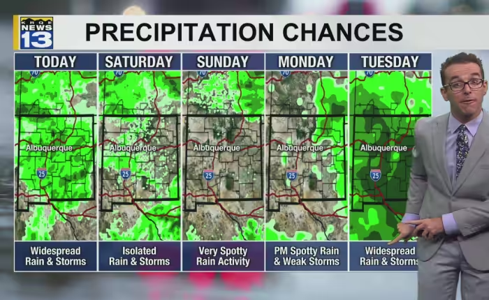
Showers and thunderstorms are spreading across much of New Mexico on Friday, with cool air, high humidity and occasional gusty winds reaching from the mountains into the Rio Grande Valley. Drier and slightly warmer conditions are expected to return by the weekend.
Overnight lows ranged from the high 40s to the low 60s across northern areas and from the upper 50s to near 70 degrees to the south, mostly a few degrees milder than average.
Afternoon temperatures will sit within a few degrees of average. Readings across eastern New Mexico and the Pecos River Valley area are forecast to range from the 70s to the 90s, increasing from north-northwest higher elevations to south-southeast lower elevations. Northern higher elevations will mostly stay in the 50s to around 60 degrees, while northern valley floors and western and central areas will reach the high 60s to the 80s.
Isolated to scattered thunderstorms are expected to form across most of the mountains through western and northern communities, parts of the Rio Grande Valley through eastern areas, and a few parts of southern New Mexico. The storms are capable of heavy downpours, some hail, very erratic wind gusts and frequent lightning strikes.
Some flooding rain will continue in the short term with relatively mild air. High pressure east of the region is moving closer to New Mexico, and combined with an upper-level disturbance to the northwest moving east, has strengthened the pipeline of Pacific moisture.
Drier air with slightly warmer air will return by the weekend as the high pressure moves back east. More moisture is expected to return next week with another drop in temperatures tied to a drop in the jet stream.