Monsoon storms, flood watches hit New Mexico through Friday
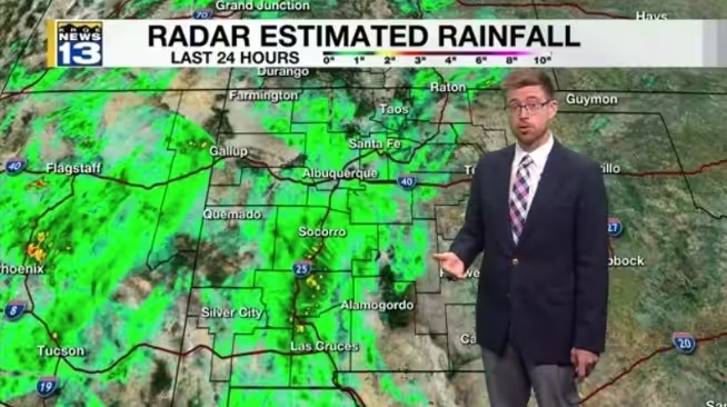
Monsoon showers and storms are expected to develop across New Mexico on Thursday afternoon and evening, with flood watches in place for much of the state. The National Weather Service has the watches in effect until 3 a.m. Friday, with locally heavy rainfall possible in several regions.
Areas under the flood watch include sections of Sierra and Socorro counties, southwest New Mexico, the Sacramento Mountains, the Albuquerque metro, southwest Colorado and northwest New Mexico. The ground is already saturated from repeated rounds of rainfall earlier this week, which will make some areas more susceptible to flash flooding.
Showers and storms may also impact the Albuquerque metro on Thursday evening before more rainfall arrives overnight.
Over the last 24 hours, parts of the Albuquerque metro picked up 0.25 to 0.75 inches of rain, with the highest accumulation ranging from 1.70 to 2.00 inches along Interstate 25 around Truth or Consequences. Light showers were indicated on radar late Thursday morning moving through Mora, Colfax and Taos counties.
A plume of monsoon moisture is expected to linger on Friday, contributing to scattered showers and storms around the state. Locally heavy rainfall is also part of Friday’s forecast.
Moisture will start to dwindle as the weekend approaches early next week. Drier air will temporarily become the dominant feature for much of New Mexico on Sunday and Monday. Rain and storm chances on Saturday will be isolated before becoming spotty the following two days. By Tuesday, moisture is expected to return, bringing another round of scattered to widespread storms to New Mexico.
Temperatures will remain near average for most of the lower elevations and valleys through next Monday. Highs by next Tuesday and Wednesday are expected to be in the 60s, 70s and 80s. Albuquerque is expected to see a slight bump in temperatures when drier air arrives for the weekend into early next week.