Warm weather and flash flooding expected across New Mexico today
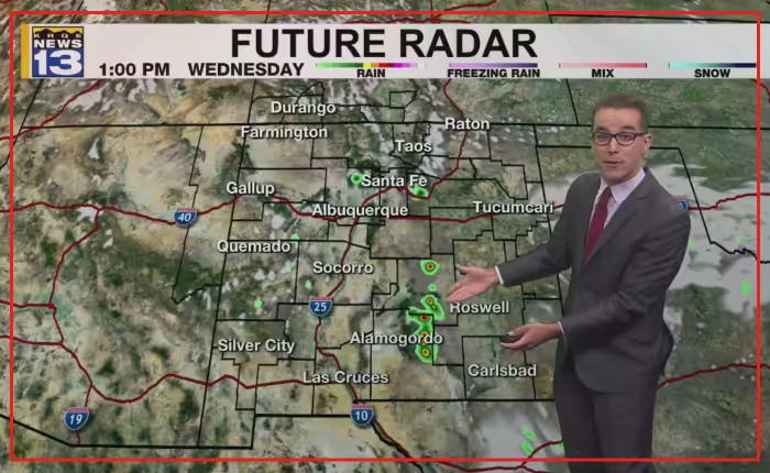
Flash flooding could become more widespread across New Mexico later today. Rising temperatures will bring very warm conditions before thunderstorms develop.
Light to moderate showers left the southeastern part of the state this morning. Union County saw a few light showers. Most of the state started the day rain-free and mostly clear.
Northern mountain areas started in the 40s. The rest of the region began in the 50s, 60s, and low 70s. The Metro area saw warmer and less humid conditions early.
Daytime heating and atmospheric moisture may produce Monsoon storms later today. A high pressure system remains to the west-northwest. The Four Corners area will stay seasonably dry with westerly winds.
Southerly winds will blow across the southeastern three-fourths of the region. Storms will develop slightly farther south than yesterday. Temperatures will reach the 70s, 80s, and 90s in most locations.
Burn-scar flash flooding is very likely around Ruidoso after the noon hour. Most other burn scars also face possible flooding. Storms will start slow along The Central Mountain Chain. They will move faster to the south-southeast.
The high pressure system will drift farther east in The Southwest later this week. Upper-level winds will pivot storm motion toward the west. Moisture could bring stormy weather closer to Albuquerque on weekend evenings. Rain chances will rise higher next week.
Monsoon weather patterns often trigger localized downpours during summer afternoons in desert regions. Burn scars left by wildfires remain vulnerable to fast-moving debris flows and sudden flooding. Drainage channels can overflow quickly when heavy rain falls over charred ground.
Storm development will shift toward western New Mexico later in the week.