Monsoon rain peaks Wednesday and Thursday across New Mexico
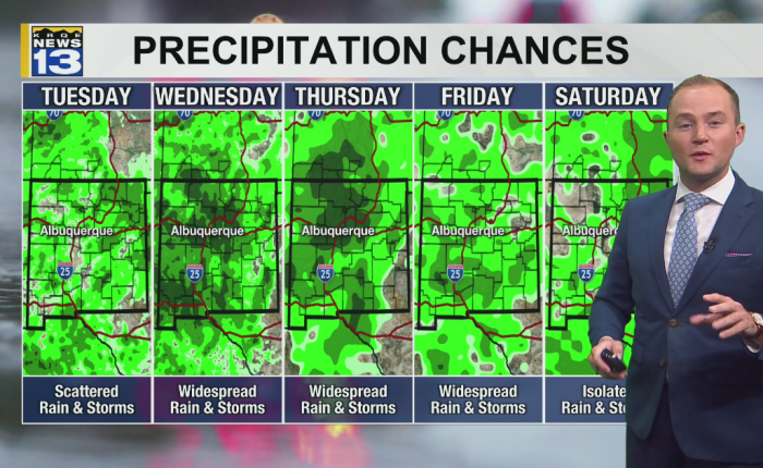
Monsoon rain peaks Wednesday and Thursday across New Mexico, with the threat of heavy rainfall and flash flooding forecast through the week. The moisture is also expected to keep temperatures below average in parts of western and central New Mexico by the end of the week.
Scattered showers and thunderstorms were moving across western, central and northern New Mexico Monday afternoon, along with southern Colorado. Some storms produced locally heavy rain and flash flooding, the forecast said.
The clouds and rain kept temperatures in the 60s across parts of western New Mexico, while drier areas of eastern New Mexico climbed into the upper 90s.
Storms were expected to continue moving northeast across the state Monday evening, then become more showery overnight.
Another round of scattered showers and thunderstorms is expected to develop Tuesday afternoon, especially near the Continental Divide and central mountain chain. Areas that receive heavy rain Monday could be more vulnerable to runoff and flooding Tuesday. Stronger storms will also be possible in northeast New Mexico as a backdoor front moves into the area.
Deep monsoon moisture is expected to remain over New Mexico on Wednesday and Thursday, bringing widespread showers and thunderstorms.
Repeated rounds of rain could continue raising the threat of flash flooding where storms repeatedly move over the same areas.
Rain chances will begin decreasing in northwest New Mexico Friday as drier air moves in. Scattered storms will continue elsewhere before rain chances gradually drop across more of the state this weekend.